
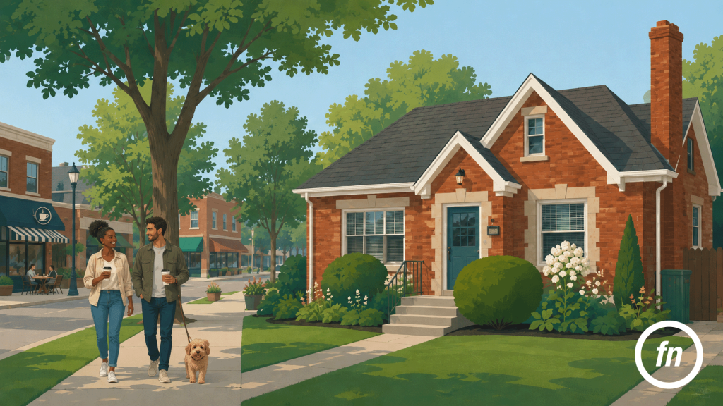
Walkability is one of those qualities that can be difficult to photograph because, unlike a renovated kitchen or a generous backyard, it does not exist neatly within the property lines. It unfolds beyond them, along the sidewalk that passes the front lawn, at the intersection at the end of the block, and through the sequence of streets that eventually leads somewhere worth going. In a city like Royal Oak, where the downtown core is known for its concentration of restaurants, shops, entertainment, and public life, that relationship between home and city can become an important part of a listing’s appeal.
It can also be easy to overstate.
A photograph of a busy downtown block can suggest an energy that feels immediate, even when the property being marketed sits well beyond a practical walk. A tightly cropped map can make destinations appear closer than they feel on foot. Phrases such as steps from downtown or walk to everything can turn a real geographic advantage into a vague promise, particularly when no one has stopped to consider the route a resident would actually take.
Thoughtful neighborhood photography should do something more useful. Rather than borrowing the atmosphere of downtown and attaching it to every Royal Oak address, it can show how a particular home relates to its actual surroundings. Sometimes that story leads directly to storefronts and restaurant patios. Sometimes it begins and ends with a quiet, tree-lined sidewalk, a nearby park, or a neighborhood route that makes an evening walk feel natural.
The point is not to make every property appear more connected than it is. It is to make location visible.
Royal Oak Is More Than Its Downtown
Downtown Royal Oak has become one of the city’s most recognizable settings, and for good reason. The concentration of restaurants, independent businesses, entertainment venues, offices, apartments, and public spaces gives the district an urban energy that feels distinct from the residential neighborhoods surrounding it. Buildings meet the sidewalk more closely, storefront windows animate the street, and the distance between destinations becomes compact enough that walking is not merely possible but often part of the experience.
Yet Royal Oak extends well beyond its downtown core. Its residential neighborhoods vary in their distance from downtown, their proximity to commercial corridors, and the kinds of destinations that can reasonably be reached on foot. A home several blocks from Main Street occupies a different geographic position from one near the city’s outer edges, even though both share a Royal Oak address.
That distinction should remain visible in real estate marketing.
For a property genuinely close to downtown, the city itself may feel like an extension of the home. A resident might leave the front porch, follow a familiar sidewalk, cross a few intersections, and arrive at dinner without getting into a car. In that case, photographs of the route and destination can add meaningful context because they describe an experience that belongs to the property.
Farther away, the story may be different but no less appealing. A home may sit on a residential block with mature trees and continuous sidewalks, close to a neighborhood park or another everyday destination while remaining a short drive from downtown. That is still valuable context; it simply deserves to be described on its own terms.
The most persuasive location story is usually the one that does not need to stretch.
The Neighborhood Story Begins at the Front Walk
A listing photographer naturally begins with the house. The façade is composed carefully, landscaping is considered, cars are moved when possible, and the frame is adjusted until the property presents itself clearly. Yet when neighborhood context matters, the edges of that photograph can be almost as informative as the house at its center.
A front walk meeting a public sidewalk establishes a small but meaningful connection between private property and the larger neighborhood. A corner visible at the end of the block suggests where that sidewalk continues. Mature street trees, neighboring porches, and the repetition of lawns and driveways can reveal the pace and scale of the street without requiring a separate photograph labeled neighborhood.
These details are particularly useful because they allow context to emerge naturally. The house remains the subject, but the viewer begins to understand what happens beyond the front lawn.
A slightly wider exterior composition might include the sidewalk passing across the property. An angled view from near the corner of the lot can reveal the length of the block. From the porch, a photograph looking outward may show the street from the perspective of someone who actually lives there. None of these images needs to announce that the neighborhood is walkable. Together, they can begin to show what walking there might feel like.
Sidewalks Are a Real Estate Detail
Sidewalks are so ordinary that they can disappear from the visual story of a listing, particularly when the camera is naturally drawn toward the architecture itself. Yet for a buyer who values the ability to leave the car behind, that narrow strip of pavement may be one of the most practical details in the frame.
Its significance is not dramatic. A sidewalk simply continues.
It carries the front walk beyond the property, past the neighboring house and toward the next block. Depending on the address, it may eventually lead to a park, a school, a neighborhood business, or the more active streets of downtown. Even when the destination is nothing more specific than a walk through the neighborhood, the physical connection matters.
Photographically, the sidewalk rarely needs to become the subject. It works better as part of a larger composition: curving beneath mature trees, continuing toward an intersection, or appearing alongside a sequence of front lawns and porches. These are quieter images than a photograph of a crowded restaurant patio or illuminated theater marquee, but they often say more about everyday life.
The question is not simply whether a sidewalk exists. It is what the sidewalk connects.
A Crosswalk Can Explain a Connection
Crosswalks occupy a similar place in the visual language of a neighborhood. On their own, painted stripes and curb ramps are hardly compelling subjects. Seen in context, however, they can help explain how one part of the city connects to another.
A marked crossing may sit between a residential block and a park. It may carry pedestrians across a busier street on the route toward downtown. A signalized intersection may reveal that a destination described as “nearby” is separated from the property by a road that buyers will actually need to cross.
That information should not be treated as an inconvenience to hide. It is part of understanding the location.
The strongest photograph of a crossing usually includes enough of the surroundings to explain why it matters. A storefront may appear beyond it. A park entrance may frame the opposite side of the street. The continuation of the sidewalk may draw the eye toward the next block. Instead of documenting a piece of infrastructure, the photograph begins to describe movement.
This is where neighborhood photography becomes more than a collection of nearby landmarks. The images should relate to one another. The home leads to the sidewalk; the sidewalk leads toward the intersection; the crossing leads to the destination. The viewer can begin to follow the geography rather than simply being told that everything is close.
Downtown Should Feel Like a Place, Not a Prop
There is plenty to photograph in downtown Royal Oak. Storefronts meet the sidewalk, restaurant patios spill into public view, pedestrians move between destinations, and the combination of older commercial buildings and newer development creates a streetscape with its own recognizable character.
The temptation is to photograph all of it.
For a real estate listing, restraint usually produces a stronger result. One carefully chosen downtown streetscape can establish atmosphere more effectively than a gallery filled with unrelated restaurants, murals, signs, and storefronts. A second image might show a destination with a genuine connection to the property—a nearby park, public space, or recognizable corner that a resident could reasonably encounter as part of everyday life.
The goal is not to create a miniature tourism campaign for Royal Oak. It is to answer a more specific question: What does living at this address place within reach?
That question changes from property to property. For one home, the answer may include an easy walk to downtown. For another, the most relevant context may be a neighborhood park or a quiet residential streetscape, with downtown remaining part of the broader city rather than the immediate surroundings.
When downtown imagery is used without that distinction, it becomes a prop. When it reflects the actual geography of the listing, it becomes useful context.
Not Every Listing Needs the Same Lifestyle Story
Real estate marketing often relies on familiar lifestyle cues. A cup of coffee on a café table suggests a leisurely morning. A restaurant patio implies evenings spent dining nearby. A photograph of cyclists or pedestrians can suggest an active neighborhood.
These images can be effective, but they can also become generic very quickly. The same coffee shop photograph could appear beside dozens of listings without explaining anything specific about any of them.
A stronger approach begins with the address and works outward.
What can someone actually reach from this home? What route would they take? What does the immediate block feel like before they arrive at a destination? Is the most meaningful nearby place a commercial district, a park, a school, or simply a network of residential streets that makes walking enjoyable?
The answer may be less dramatic than the standard lifestyle narrative, but it will also be more particular to the property.
That specificity is what gives editorial neighborhood photography its value. It does not merely say, Here is the kind of life you could imagine. It shows the physical setting in which that life would actually unfold.
A Map Can Say What a Photograph Cannot
Photography is particularly good at atmosphere. It can show the shade beneath a canopy of street trees, the activity of a downtown block, or the visual transition from a residential street to a commercial one. What it cannot do especially well is establish precise distance.
That is where a map becomes useful.
A restrained map can locate the property and identify a small number of relevant destinations without overwhelming the viewer with icons. If downtown is central to the listing’s location story, the map can show where the home sits in relation to the core. If a park or another destination is more immediate, that relationship may deserve greater emphasis.
The key is scale. A map cropped too tightly can make two locations appear deceptively close because the viewer has no larger geographic reference. A large circular radius can include destinations that may be technically nearby while saying very little about the route required to reach them. Straight-line distance can be equally misleading when a pedestrian must follow a different path.
A useful map should therefore clarify rather than decorate. The property should be easy to locate, the destinations should be selective, and any walking claim should reflect the route a person can actually use.
Royal Oak’s own mapping resources can help establish geographic context, but the final graphic does not need to reproduce every available layer of information. Like a good photograph, it should know what to leave out.
Walkability Language Should Be Specific
The word walkable can describe several different experiences. A neighborhood may have sidewalks but few nearby destinations. A home may be within a comfortable walk of a park but not downtown. A property may sit close to a commercial district while requiring the pedestrian to cross a major road along the way.
None of these conditions can be explained particularly well by the word walkable alone.
Specific language is more useful. A listing can say that a home is three blocks from a neighborhood park, connected to nearby streets by sidewalks, within a practical walk of downtown shops and restaurants, or a short drive from the city center. Each statement creates a different expectation, and each can be supported by photography, mapping, or both.
This is especially important with phrases such as steps from downtown and walk to everything. They are attractive because they compress an entire location story into a few words, but they can also become meaningless when used too broadly.
If walking is part of the marketing, the route deserves to be understood. Distance matters, but so do crossings, street design, and the destinations themselves. The most credible language is the language that a buyer can experience after arriving and recognize as true.
The Camera Should Not Make the City Smaller Than It Is
Every photograph interprets space.
A wide lens can make a room feel more expansive. A telephoto lens can visually compress distant buildings. A carefully selected angle can emphasize one relationship while hiding another. These are normal photographic decisions, but they take on a different significance when an image is being used to suggest proximity.
A long-lens photograph of a distant downtown building may make it appear much closer to a residential street than it feels on foot. A crop can remove the major road separating a home from a destination. An aerial image can make several blocks look insignificant when the actual pedestrian experience is more complicated.
The solution is not to avoid attractive compositions. It is to understand what those compositions imply.
Neighborhood photography should be held to the same standard as interior photography: present the subject beautifully, but do not ask perspective to create a substantially different experience from the one a buyer will encounter in person.
Restraint, in this case, is not a lack of creativity. It is a form of accuracy.
A Walkable Story Is Best Told as a Sequence
The relationship between a house and its surroundings is rarely contained in one image. It unfolds.
A thoughtful sequence might begin with the home itself, photographed widely enough that the sidewalk remains visible. The next image could move toward the corner or the route beyond the property. If there is a meaningful crossing, park, commercial block, or downtown destination nearby, the gallery can arrive there gradually. A simple map can then bring those pieces together.
The effect is subtle, but it changes the way the viewer understands location. Instead of encountering a random photograph of downtown Royal Oak inserted between the kitchen and primary bedroom, the buyer can follow a visual progression from private space to public life.
For a home near downtown, that progression might begin on a quiet residential street and gradually become more urban as storefronts and activity appear. For a property farther away, the story may remain closer to home, focusing on sidewalks, mature trees, neighborhood parks, and the character of the immediate blocks.
Neither narrative is inherently better. The important thing is that the media follows the geography rather than forcing the geography to follow the marketing.
Neighborhood Context Should Support the House
There is a point at which lifestyle imagery can overwhelm the property it is supposed to support. A buyer opens a listing expecting to see a home and instead encounters restaurant patios, coffee shops, murals, parks, and downtown aerials before getting a clear sense of the second floor.
The neighborhood matters, but the house should remain the center of the story.
A restrained gallery keeps that hierarchy intact. The primary photographs establish the property. Neighborhood images appear where they add information the house itself cannot provide. Maps clarify relationships that photographs cannot easily explain. Captions identify what is shown without suggesting that every destination sits just beyond the front door.
For professional real estate media in Royal Oak, this approach is particularly useful because the city’s reputation for walkability is a genuine asset, but not one that every address experiences in exactly the same way. The goal should not be to prove that Royal Oak is an appealing place to live. The city already has its own identity.
The more interesting task is to show how one particular home fits within it.
Walkability Should Be Shown With Restraint
The most convincing way to communicate walkability is rarely to repeat the word itself. It is to show the physical details that make walking possible and the destinations that make it worthwhile.
A sidewalk leaving the front lawn. A corner at the end of the block. A crossing that connects one side of the neighborhood to another. A downtown streetscape that is genuinely within reach. A map that allows the buyer to understand how those pieces fit together.
Royal Oak’s downtown can be an important part of a property’s appeal, but the city is larger and more varied than its commercial core. Some homes place restaurants and shops within an everyday walk. Others offer quieter residential surroundings, neighborhood connections, and a different relationship to downtown.
Both can be compelling stories when they are told accurately.
Thoughtful real estate photography does not need to make the city feel smaller than it is. It simply needs to show where the property sits within it, allowing sidewalks, streets, crossings, and distance to speak with the same clarity as the rooms inside the house.
