
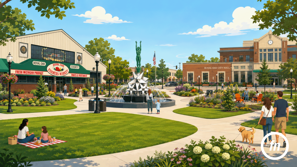
A property photograph begins at the address, but the story of living there does not always end at the lot line. In Royal Oak, a buyer may be drawn as much to the rhythm of the surrounding city as to the rooms inside the house: Saturday morning beneath the broad roof of the Farmers Market, an afternoon crossing Centennial Commons, or an evening walk through one of the small parks folded into the residential grid. These places help explain why someone might choose Royal Oak, yet they require a different kind of photographic judgment than a kitchen, bedroom, or front elevation.
The temptation is to treat neighborhood amenities as a collection of attractions. A listing near downtown suddenly acquires photographs of restaurant patios, theater marquees, fountains, playgrounds, and market stalls, each one adding color but not necessarily clarity. The gallery begins to resemble a visitor’s guide, while the property—the reason the viewer opened the listing—quietly loses its place at the center.
A stronger amenity image does less. It identifies one meaningful connection between the house and its surroundings, then allows that connection to remain specific. The Farmers Market may help explain a weekly ritual. Centennial Commons may reveal how the civic center has become a place to sit rather than merely pass through. A neighborhood park may communicate the presence of green space without suggesting that every Royal Oak address is surrounded by recreational amenities.
The goal is not to prove that Royal Oak contains interesting places. It is to show which of those places genuinely belong to the story of a particular home.
The Amenity Image Is Not a Postcard
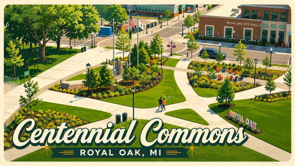
A postcard is designed to stand alone. It isolates the most recognizable view, heightens its atmosphere, and asks the viewer to remember the destination rather than understand its relationship to anything else. An amenity photograph in a real estate listing has a different responsibility. It should clarify where the property sits within the city and what a resident could reasonably experience from that location.
That difference is subtle, but it changes where the photographer stands. A postcard image of downtown might favor the busiest intersection, the fullest restaurant patio, or the most dramatic evening light. A listing image may be quieter: the entrance to a nearby park, the sidewalk approaching the market, or a wider view of Centennial Commons that includes City Hall and the library. The most useful frame is not necessarily the most spectacular one. It is the one that helps the viewer understand place.
This is particularly important in Royal Oak because its amenities are recognizable enough to be borrowed too easily. The presence of the Farmers Market or Centennial Commons within the city does not make either location immediately relevant to every listing. A house near downtown may have a practical relationship to both. A property farther north may be better represented by a neighborhood park, a tree-lined route, or no separate amenity photograph at all.
Accurate context builds confidence. Decorative context merely fills the gallery.
The Farmers Market Is More Than a Saturday Errand
The Royal Oak Farmers Market has occupied a place in the city’s public life for approximately a century. It began in 1925 as an open-air municipal market intended to serve a rapidly growing community, and a permanent brick building followed in 1927. The structure covered roughly 23,000 square feet, with a concrete floor designed so vehicles could enter for unloading; on its first day, more than 300 customers purchased goods from 75 producers.
Those details help explain why the market feels more substantial than a temporary row of seasonal tents. The building was created as civic infrastructure, a place where growers, shoppers, vehicles, food, and public life could occupy the same broad interior. Over time it also hosted dances, public meetings, craft shows, community events, and even temporary fire-truck storage, expanding its role well beyond produce sales. The Saturday farmers market continues year-round, while the Sunday antiques and collectibles market has developed its own weekly following.
For a nearby property, that history gives the market photograph more meaning. The image is not simply saying that fresh vegetables can be purchased close to the house. It is showing a place that has participated in Royal Oak’s growth and remained part of its weekly routine through several generations.
The strongest photograph would resist the urge to turn that routine into spectacle. A carefully composed exterior might include the brick market building, its signage, the entrance, and enough surrounding street context to make the location recognizable. An interior image made during market hours could show the broad structure in use—vendors beneath the roof, shoppers moving between tables, daylight entering through the building—without focusing so tightly on one product display that the place itself disappears.
The market matters because it is both ordinary and enduring. Residents return not for a single landmark experience but for repetition: the familiar parking approach, the same entrance, the movement through stalls, and the possibility of encountering someone they know. The amenity image should preserve some of that everyday quality.
Centennial Commons Reframed the Civic Core
Centennial Commons tells a more recent story. The two-acre downtown park opened in 2021 to coincide with Royal Oak’s centennial and formed part of a larger civic redevelopment that included a new City Hall and police station. Where the site once contained parking and outdated municipal buildings, the city introduced gardens, lawns, play areas, a water feature, a climbing wall, seating, and spaces for public gathering.
The park’s location is as important as its individual features. It sits beside City Hall and the Royal Oak Public Library, within walking distance of downtown businesses and restaurants. The Barbara A. Hallman Memorial Plaza incorporates the Star Dream Fountain, a sculpture by Marshall Fredericks, as well as the city’s Veterans War Memorial.
Before Centennial Commons, this part of downtown could be understood primarily as a collection of civic buildings and the spaces needed to reach them. The park changed the composition. Lawns and pathways now soften the relationship between institutional architecture, streets, sidewalks, and public life. A resident can cross the area on the way elsewhere, but the design also creates reasons to remain: a bench, a patch of lawn, the sound of the water feature, or a gathering taking place near the stage.
That transformation makes the Commons especially useful as an amenity image, provided the listing truly has a meaningful relationship to downtown. A wide view can explain the park as part of the civic core, allowing City Hall, the library, planting beds, pathways, and people to share the frame. A tighter photograph of the fountain or climbing wall may be attractive, but it risks reducing the park to a single feature. The larger story is the way open space now connects the buildings and activities around it.
The photograph should therefore feel inhabited but not staged. A few people crossing the lawn or sitting along a path can establish scale and use. An entirely empty park may appear overly formal; a crowded event photograph may imply a level of daily intensity that is not always present. The most accurate image often lies between those extremes, showing Centennial Commons as a civic room that Royal Oak residents can enter, use, and move through.
Civic Amenities Should Be Photographed at Their Everyday Scale
Large amenities are frequently photographed from above because aerial views make their organization immediately legible. Centennial Commons is particularly graphic from the air: lawns, paths, buildings, and paved areas form a clear pattern within the downtown core. The Farmers Market can also be situated in relation to Eleven Mile Road, nearby parking, and the surrounding blocks.
An aerial image can be useful, but it changes the viewer’s relationship to the place. From above, a park becomes a plan and a market becomes a roof. The image explains geography while revealing relatively little about the experience of arriving on foot.
For most listing galleries, the eye-level photograph should come first. It shows the height of the market entrance, the width of the Commons path, the scale of the plantings, and the way the surrounding buildings appear to someone actually standing there. Aerial context can follow when distance, route, or downtown proximity requires further explanation.
This is the same principle that guides good interior photography. A floor plan can explain how rooms fit together, but it cannot replace the experience of seeing the rooms themselves. Likewise, a drone image can organize Royal Oak’s civic amenities geographically without fully describing what they feel like at street level.
Both perspectives have value. Neither needs to carry the entire story.
Parks Work Best as Quiet Context
Royal Oak maintains more than 50 parks and recreation spaces, ranging from urban plazas and small neighborhood parks to larger community facilities and natural reserves. Together, the city’s parkland includes more than 300 acres of woodlands and recreational space, with some parks emphasizing active uses and others functioning primarily as places for retreat.
This variety is precisely why the word park is not descriptive enough on its own. Memorial Park, with its athletic fields and prominent Woodward Avenue location, tells a different story from a small green space embedded within a residential neighborhood. A nature reserve suggests another experience entirely. The photograph needs to reflect the particular park near the listing rather than using interchangeable greenery to imply a broadly desirable lifestyle.
Neighborhood parks often work best when photographed quietly. An entrance sign can identify the location, while a wider composition of a path, mature trees, open lawn, or playground establishes what is actually available. The image does not need a family arranged on a blanket or a runner placed deliberately in the foreground. Empty space can be useful when the physical features remain clear.
The route to the park may be equally important. A photograph of a continuous sidewalk, a marked crossing, or a tree-lined block can sometimes explain proximity more honestly than a close view made inside the park itself. The amenity is not simply the destination; it is the relationship between the home and the path required to reach it.
This is where Royal Oak real estate photography can become particularly attentive to local experience. The purpose is not to add a generic image of green space to every gallery. It is to identify whether a nearby park contributes something meaningful to the property’s location story and, when it does, to show the connection without exaggeration.
Maps Can Clarify What the Image Leaves Unsaid
Photography is strong at atmosphere but imprecise about distance. An image of the Farmers Market may show the brick building clearly, yet it cannot establish whether the listing is two blocks away, two miles away, or simply somewhere within Royal Oak. A photograph of Centennial Commons can communicate the character of the civic core without explaining the route from the property.
A restrained map can resolve that ambiguity. The property, amenity, and practical route can be presented together, with enough surrounding streets to prevent the geography from appearing artificially compressed. The graphic should identify only the destinations that matter to the listing rather than surrounding the home with a halo of loosely related attractions.
The same principle applies to written language. Near the Royal Oak Farmers Market is broad. Three blocks from the Farmers Market is more specific. A short drive from Centennial Commons creates a different expectation from within walking distance of Centennial Commons. Each description should be based on the actual address and supported by a route that a resident could reasonably use.
The map does not need to be decorative. Its function is to keep the amenity photograph honest.
Every Listing Needs Only One or Two Amenity Images
A property gallery has a hierarchy. The exterior introduces the house, the interior establishes how it lives, the backyard and secondary structures complete the site, and a floor plan gathers the rooms into a larger understanding. Neighborhood amenities belong within that sequence, but they rarely need to dominate it.
For many listings, one contextual photograph is enough. A house near the Farmers Market might include a carefully composed market exterior near the end of the gallery. A downtown condominium could justify one view of Centennial Commons and perhaps a second streetscape showing the route toward nearby businesses. A home near a small park may need only an entrance or path image, particularly when the park’s proximity is already made clear by a map.
Adding more does not necessarily make the location story stronger. Five market photographs can make the property feel secondary. A succession of downtown landmarks may suggest that the listing depends on borrowed atmosphere because the house itself has not been presented confidently enough. Repetition also weakens the value of each image; what felt specific in one frame begins to feel promotional by the fifth.
Restraint creates emphasis. When a single amenity photograph appears after a thoughtfully sequenced property gallery, the viewer is more likely to understand why it was included.
The image has earned its place.
The Listing Should Return to the House
The final neighborhood photograph should not leave the viewer wandering indefinitely through downtown Royal Oak. The gallery still needs to belong to the property.
That return can be literal. After showing Centennial Commons, the sequence may conclude with an aerial of the home and surrounding blocks, followed by the floor plan or final exterior. It can also be accomplished through copy: a caption that explains the amenity’s relevance to the address rather than describing the destination in isolation.
For example, a market caption should not read like a tourism brochure listing vendors, events, and operating hours. It might instead note that the year-round market sits a few blocks from the property and has served Royal Oak residents since the 1920s. The historical detail adds depth, while the geographic statement keeps the listing at the center.
This is the difference between showing Royal Oak and marketing Royal Oak. The first provides context. The second can easily overwhelm the home with a broader civic identity that belongs equally to thousands of other properties.
A listing becomes more persuasive when the viewer understands both scales: the character of the house and the part of the city immediately available from it.
A Sense of Place Requires Selection
Centennial Commons and the Royal Oak Farmers Market represent two very different periods in the city’s development. The market emerged during Royal Oak’s early twentieth-century growth and became a durable gathering place shaped by repetition, trade, and community use. Centennial Commons arrived nearly a century later, replacing parking and outdated civic structures with a contemporary public landscape designed for gathering, recreation, and movement.
Both can add meaningful context to a real estate listing. Neither belongs automatically.
The best amenity image is selected with the same care as the best interior angle. It considers distance, relevance, scale, and what the photograph contributes that the rest of the gallery cannot. The Farmers Market may suggest a weekly routine. Centennial Commons may clarify a downtown lifestyle. A neighborhood park may communicate something quieter: shade, open space, or a nearby place to walk.
One or two accurate images are usually enough. They give the listing a sense of place without asking the property to become an advertisement for the entire city.
Because the goal is not to show buyers everything Royal Oak has to offer. It is to show them what living at this particular address places within reach.
